
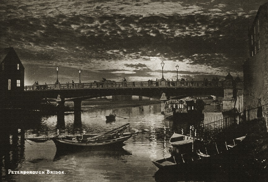
This shows a view at sunset of the River Nene near the old Customs House. The ‘old’ iron bridge, which was built in 1872, replacing a very old rickety wooden one is in the background. This bridge was replaced in 1934 with a concrete version which also spanned the east coast railway which aided access from the south side of the river.
This image has been produced from an original postcard of the time. Publisher unknown, from the Jacqui Catlin Collection.
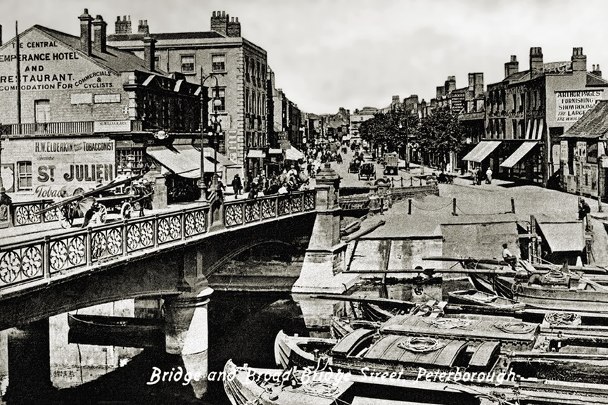
This is a view of the River Nene looking north along Broad Street which led to Narrow Street. At this time Peterborough was an inland port receiving barges from the coast via Wisbech and Kings Lynn. The old iron bridge is clearly visible and the Customs House, which is out of view is still on the right hand side. On the left hand side today are flats and The Rivergate Centre.
This image has been produced from an original postcard of the time. Publisher unknown, from the Jacqui Catling Collection.
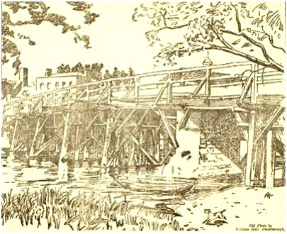
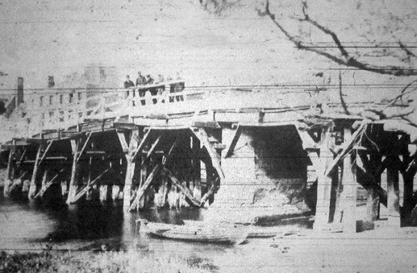
The first bridge over the River Nene in Peterborough is attributed to the Abbot of Peterborough, Godfrey of Crowland/Croyland, in 1308. The bridge spans the boundary between Peterborough (Lincoln) diocese and Ely and is possibly built over a previous ford. It has also linked Northamptonshire to Huntingdonshire, the Soke or Liberty of Peterborough to Cambridgeshire (and various versions of this). The bridge lasted for around 600 years until it was replaced by a metal bridge in 1872.
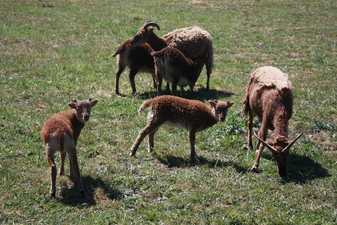
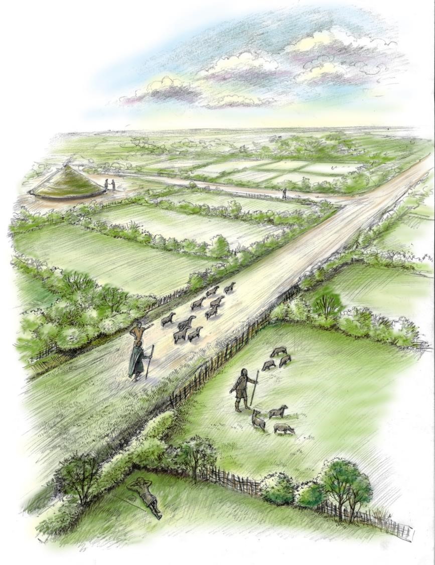
By 1500 BC the lower Nene Valley and Fen-edge regions of Peterborough had become one of the most prosperous landscapes in prehistoric Britain, fertile and rich in resources.The local population was well into the thousands and there were tens of thousands of cattle and sheep grazing the elaborately arranged field systems around the Fen margins. Most of the farms and settlements were on the drier, flood-free margins of the wetlands, but a few were constructed over the water on wooden piles, such as the one at Must Farm.
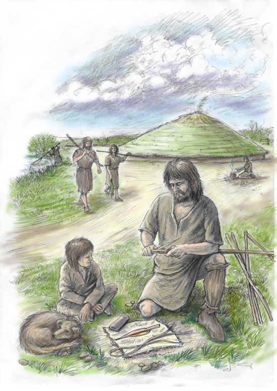
During the Neolithic the local population had grown from hundreds to perhaps a few thousand people. This process gathered pace in the Bronze Age, which is named after the arrival of metal-workers in Britain, around 2500 BC. As the population grew it became necessary to divide-up the landscape into field systems; some of the earliest fields in England are found in Peterborough.
Meanwhile North Sea levels were steadily rising and the nearby floodplain of the River Nene became permanent Fen. Animals were grazed on its lush summer pastures. Major sites of this time have been found at Fengate, Must Farm and Bradley Fen.
There are many bridges across the River Nene in Peterborough. These include road, rail and pedestrian bridges as diverse as the early eighteenth century ashlar stone Ferry Bridge in Nene Park and Shanks Millennium Bridge near Flag Fen. People have always needed to cross the river, but they haven't always used bridges to do so.
Bridges are expensive and complicated to both build and maintain, and even more so before the use of industrial metals and quarrying techniques. A simpler solution was to cross the river where it was shallowest and create a ford, or to organise a boat to ferry people across the river. Both techniques were used at the Ferry Bridge site, which is said to date back to at least the Roman occupation of the area, but there were others that have been forgotten.
Botolph Bridge or Bottle Bridge was a hamlet sat on the south side of the River Nene. Its name is believed to come from a river crossing that once existed there. A court roll from 1428 references a ford linking Botolph and Longthorpe, with further documents suggesting landowners held property in both areas, which would be impractical if the two areas were not directly linked across the river. The name Botolph also links the two areas, with Longthorpe church named after St Botolph and a myth linking Botolph to the spring there too.
The ford fell out of use, as did the hamlet of Botolph Bridge, leaving us with an unusual name and a question as to where the ford was. The church for Botolph Bridge gives us a clue in its siting, which was close by to the junction of Nene Valley Railway's Fletton Loop , and lidar hints at an old hollow way now hidden in the landscape, that may have led to the crossing. The land around the possible crossing in public recreation land, so do take a look, but remember to be careful of the river and avoid trespassing on the railway.
Photo Credit: Rawney Ford by John Walton via Wikipedia

This shows a view at sunset of the River Nene near the old Customs House…
This is a view of the River Nene looking north along Broad Street which…
The first bridge over the River Nene in Peterborough is attributed to th…
By 1500 BC the lower Nene Valley and Fen-edge regions of Peterborough ha…
During the Neolithic the local population had grown from hundreds to per…
There are many bridges across the River Nene in Peterborough. These incl…


